Longridge Road, Malvern Common
Introduction
The photograph on this page of Longridge Road, Malvern Common by Bob Embleton as part of the Geograph project.
The Geograph project started in 2005 with the aim of publishing, organising and preserving representative images for every square kilometre of Great Britain, Ireland and the Isle of Man.

There are currently over 7.5m images from over 14,400 individuals and you can help contribute to the project by visiting https://www.geograph.org.uk
Longridge Road, Malvern Common
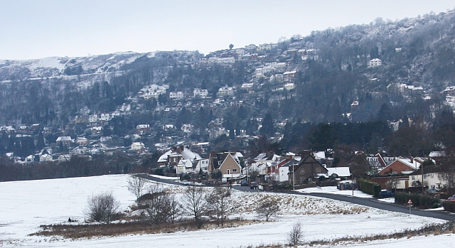
Image: © Bob Embleton Taken: 3 Feb 2009
The dusting of snow enhances the houses of the Wyche on the eastern side of the Malvern Hills. The notch of the Wyche Cutting can just be seen in the centre skyline. Wyche is the old english word for salt - as in Droitwich, Nantwich etc. This was a salt route over the hills.
Images are licensed for reuse under creativecommons.org/licenses/by-sa/2.0
Image Location
Latitude
52.096252
Longitude
-2.317595