Eton Wick: Confluence of Roundmoor Ditch with Cress Brook
Introduction
The photograph on this page of Eton Wick: Confluence of Roundmoor Ditch with Cress Brook by Nigel Cox as part of the Geograph project.
The Geograph project started in 2005 with the aim of publishing, organising and preserving representative images for every square kilometre of Great Britain, Ireland and the Isle of Man.

There are currently over 7.5m images from over 14,400 individuals and you can help contribute to the project by visiting https://www.geograph.org.uk
Eton Wick: Confluence of Roundmoor Ditch with Cress Brook
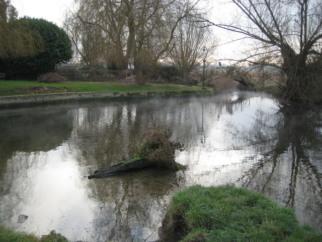
Image: © Nigel Cox Taken: 9 Jan 2009
Roundmoor Ditch, on the left, joins with Cress Brook, on the right, here to form Boveney Ditch. Although these watercourses are known as "Ditches" they are large enough in terms of width and depth to be bigger than many so-called rivers. Eagle-eyed viewers will spot the heron, and the faint wisp of steam coming off the surface of Roundmoor Ditch caused by the air temperature being much lower than the water temperature.
Images are licensed for reuse under creativecommons.org/licenses/by-sa/2.0
Image Location
Latitude
51.496615
Longitude
-0.644549