Kingston near Lewes
Introduction
The photograph on this page of Kingston near Lewes by Kevin Gordon as part of the Geograph project.
The Geograph project started in 2005 with the aim of publishing, organising and preserving representative images for every square kilometre of Great Britain, Ireland and the Isle of Man.

There are currently over 7.5m images from over 14,400 individuals and you can help contribute to the project by visiting https://www.geograph.org.uk
Kingston near Lewes
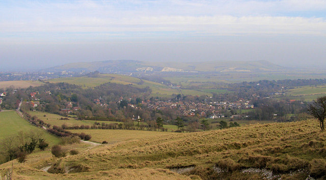
Image: © Kevin Gordon Taken: 31 Jan 2009
Until the 1920s Kingston was just a small village of one street with a few houses, one school, one pub and one church. Since then it has expanded considerably attracting lecturers from the nearby Sussex University at Falmer. The lane to the left is Kingston Ridge. The county town of Lewes can be seen on the left with Malling Hill Image towards the centre and Mount Caburn Image on the right.
Images are licensed for reuse under creativecommons.org/licenses/by-sa/2.0
Image Location
Latitude
50.858422
Longitude
-0.026864