Holmsley, milepost
Introduction
The photograph on this page of Holmsley, milepost by Mike Faherty as part of the Geograph project.
The Geograph project started in 2005 with the aim of publishing, organising and preserving representative images for every square kilometre of Great Britain, Ireland and the Isle of Man.

There are currently over 7.5m images from over 14,400 individuals and you can help contribute to the project by visiting https://www.geograph.org.uk
Holmsley, milepost
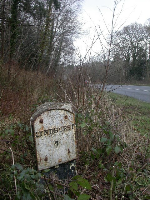
Image: © Mike Faherty Taken: 29 Jan 2009
Milepost on the A35 just south of Holmsley Mill. Concrete post (unusual), triangular plan, with two metal plates attached. The other side reads "Xt. CHURCH/7/BOURNE/12"; note the abbreviations for Christchurch & Bournemouth. Probably mid-C19 plates; post might be later.
Images are licensed for reuse under creativecommons.org/licenses/by-sa/2.0
Image Location
Latitude
50.800725
Longitude
-1.674144