Houses, Staplegrove Road, Taunton
Introduction
The photograph on this page of Houses, Staplegrove Road, Taunton by Derek Harper as part of the Geograph project.
The Geograph project started in 2005 with the aim of publishing, organising and preserving representative images for every square kilometre of Great Britain, Ireland and the Isle of Man.

There are currently over 7.5m images from over 14,400 individuals and you can help contribute to the project by visiting https://www.geograph.org.uk
Houses, Staplegrove Road, Taunton
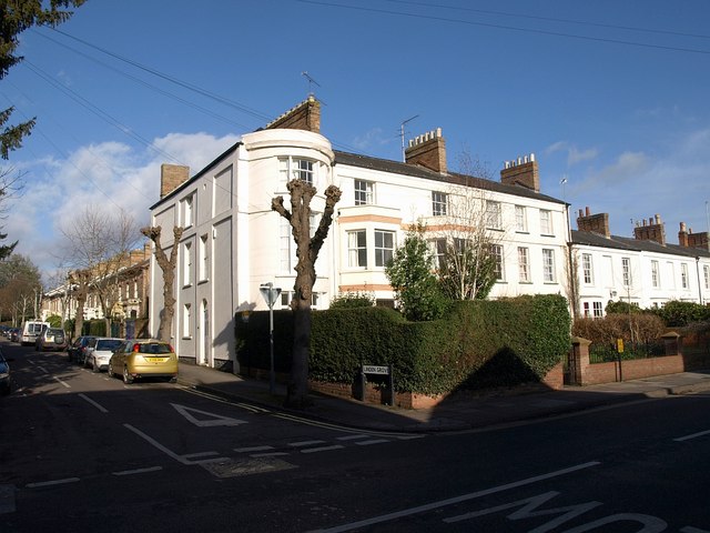
Image: © Derek Harper Taken: 24 Jan 2009
A little way east (towards the town) from Image, the bay-fronted house makes an impressive end to a terrace facing Staplegrove Road, the main road leading northwestwards out of Taunton. The side road is Linden Grove.
Images are licensed for reuse under creativecommons.org/licenses/by-sa/2.0
Image Location
Latitude
51.019809
Longitude
-3.110572