The Bar House, Pool Bank
Introduction
The photograph on this page of The Bar House, Pool Bank by Gordon Hatton as part of the Geograph project.
The Geograph project started in 2005 with the aim of publishing, organising and preserving representative images for every square kilometre of Great Britain, Ireland and the Isle of Man.

There are currently over 7.5m images from over 14,400 individuals and you can help contribute to the project by visiting https://www.geograph.org.uk
The Bar House, Pool Bank
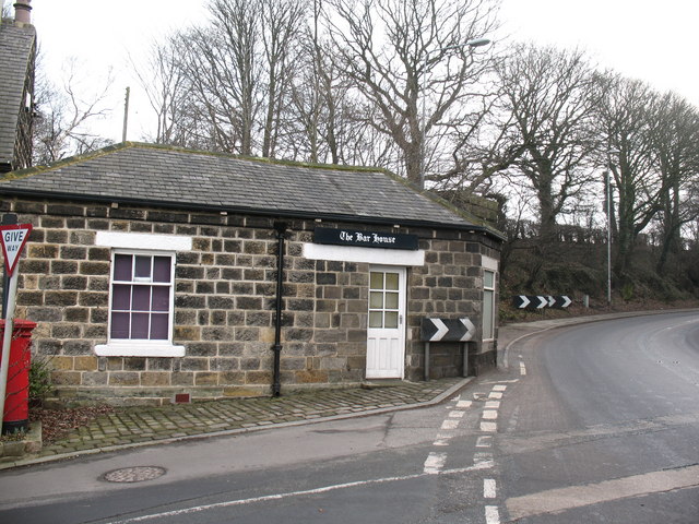
Image: © Gordon Hatton Taken: 27 Jan 2009
A toll bar dating from the days of the turnpike road, but the question is which of these roads was the turnpike in the 18th century? The main road [A660 right] was built to replace the Old Otley Road which is further to the SW. The minor road [left] is Old Pool Bank, but was this a turnpike on the route from Dudley Hill in Bradford to Killinghall, or was the turnpike the current A658 further east? Perhaps someone out there knows the answer. Just visible over the right hand end of the Bar House is the abutment of a bridge that once carried a tramway over the main road, linking quarries at SE233433 and SE242434 with the railway at Pool station [SE248437]. A visitor to the website has reminded me that the current A658 Bradford to Pool road was the line of the Dudley Hill and Killinhall turnpike, so this toll house at Chain Bar was on the Leeds to Skipton route.
Images are licensed for reuse under creativecommons.org/licenses/by-sa/2.0
Image Location
Latitude
53.894784
Longitude
-1.639628