Coventry Market car park
Introduction
The photograph on this page of Coventry Market car park by E Gammie as part of the Geograph project.
The Geograph project started in 2005 with the aim of publishing, organising and preserving representative images for every square kilometre of Great Britain, Ireland and the Isle of Man.

There are currently over 7.5m images from over 14,400 individuals and you can help contribute to the project by visiting https://www.geograph.org.uk
Coventry Market car park
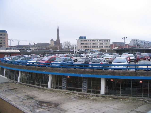
Image: © E Gammie Taken: 27 Jan 2009
Cars parked on the roofs of the single storey Coventry Market and shops in Market Way. Opened in 1958, the indoor market is circular in plan and houses stalls set out in concentric rings with a children's roundabout under the light well in the centre (visible to the right of this photo). Visible on the horizon is the tower of the Methodist Central Hall and, to its right, Greyfriars/Christchurch spire. Interestingly, neither are shown with the usual place of worship symbols on the map (Christchurch is no longer active, only the spire remains; Central Hall is still active).
Images are licensed for reuse under creativecommons.org/licenses/by-sa/2.0
Image Location


Leaflet Map data © OpenStreetMap
Latitude
52.407108
Longitude
-1.514272