Shute Barton Manor House
Introduction
The photograph on this page of Shute Barton Manor House by David Martin as part of the Geograph project.
The Geograph project started in 2005 with the aim of publishing, organising and preserving representative images for every square kilometre of Great Britain, Ireland and the Isle of Man.

There are currently over 7.5m images from over 14,400 individuals and you can help contribute to the project by visiting https://www.geograph.org.uk
Shute Barton Manor House
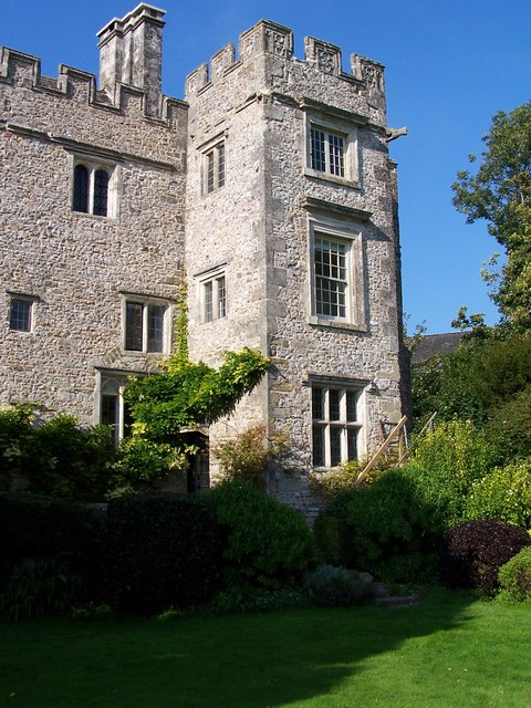
Image: © David Martin Taken: 20 Sep 2008
In the care of the National Trust, this Medieval manor house is only open to the public on certain days. The view here is from the garden, with the roof of the village church visible through the trees to the right.
Images are licensed for reuse under creativecommons.org/licenses/by-sa/2.0
Image Location
Latitude
50.771349
Longitude
-3.06128