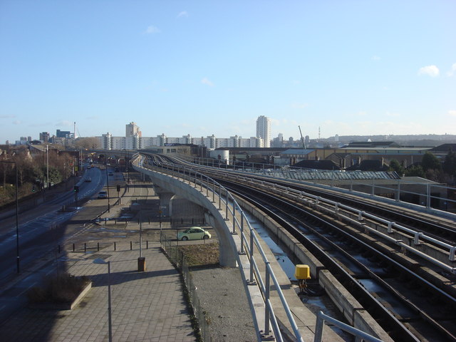
Elevated railway line to the east of West Silvertown DLR station
Introduction
The photograph on this page of Elevated railway line to the east of West Silvertown DLR station by Oxyman as part of the Geograph project.
The Geograph project started in 2005 with the aim of publishing, organising and preserving representative images for every square kilometre of Great Britain, Ireland and the Isle of Man.
There are currently over 7.5m images from over 14,400 individuals and you can help contribute to the project by visiting https://www.geograph.org.uk

Image: © Oxyman Taken: 17 Jan 2009
Taken from the east end of West Silvertown Docklands Light Railway station. The A1020, North Woolwich Road can be seen to the left, for an image of this road from ground level see Image The Docklands Light Railway runs closely to the line of the former 'Silvertown Tramway' although the latter was at ground level. The Tramway provided connections to/from the numerous industrial companies that lined the riverside with the national rail network via Stratford. The North Woolwich branch of the Eastern Counties, later the Great Eastern railway arrived a few years later and the Tramway became part of that line. It ceased to be used in the 1980s and has been removed.

