St. Andrew's Cross
Introduction
The photograph on this page of St. Andrew's Cross by G Laird as part of the Geograph project.
The Geograph project started in 2005 with the aim of publishing, organising and preserving representative images for every square kilometre of Great Britain, Ireland and the Isle of Man.

There are currently over 7.5m images from over 14,400 individuals and you can help contribute to the project by visiting https://www.geograph.org.uk
St. Andrew's Cross
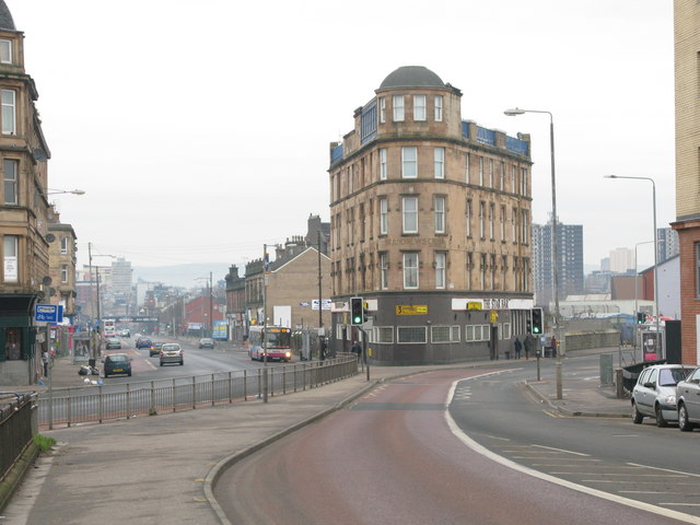
Image: © G Laird Taken: 26 Dec 2008
Better known now as Eglinton Toll and really no longer a cross with the pavement division between Eglinton Street (A77) on the left and Victoria Road on the right. This division did not exist many years ago in the days of the trams when there used to be a large shelter at the tram stop in front of the dominant and highly distinctive tenement building in the centre of the photograph.
Images are licensed for reuse under creativecommons.org/licenses/by-sa/2.0
Image Location
Latitude
55.842973
Longitude
-4.262644