Stroudley Road
Introduction
The photograph on this page of Stroudley Road by Simon Carey as part of the Geograph project.
The Geograph project started in 2005 with the aim of publishing, organising and preserving representative images for every square kilometre of Great Britain, Ireland and the Isle of Man.

There are currently over 7.5m images from over 14,400 individuals and you can help contribute to the project by visiting https://www.geograph.org.uk
Stroudley Road
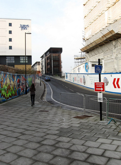
Image: © Simon Carey Taken: 11 Jan 2009
Taken from the junction with Fleet Street. The fences to the left cover an area waiting to be developed as a hotel, the architects initially wished to construct a 42 story tower but were refused planning permission. Jurys Inn has been completed and is now in operation, an eco-friendly block known as One Brighton is unfinished to the right whilst the houses above a built on the former supports of locomotive works. The drop in gradient of the road marks the spot were the locomotive works ended and the land once occupied by goods yard begins.
Images are licensed for reuse under creativecommons.org/licenses/by-sa/2.0
Image Location
Latitude
50.831407
Longitude
-0.139765