Mease de Dieu
Introduction
The photograph on this page of Mease de Dieu by Richard Croft as part of the Geograph project.
The Geograph project started in 2005 with the aim of publishing, organising and preserving representative images for every square kilometre of Great Britain, Ireland and the Isle of Man.

There are currently over 7.5m images from over 14,400 individuals and you can help contribute to the project by visiting https://www.geograph.org.uk
Mease de Dieu
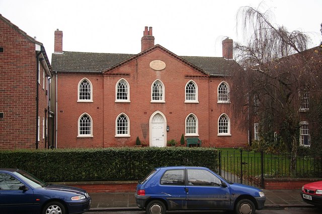
Image: © Richard Croft Taken: 7 Jan 2009
Sloswicke's Hospital in Churchgate, almshouses founded in 1657 by the will of Richard Sloswicke for "six poore old men", rebuilt 1806 in Regency Gothick and further altered in 1819.
Images are licensed for reuse under creativecommons.org/licenses/by-sa/2.0
Image Location


Leaflet Map data © OpenStreetMap
Latitude
53.324197
Longitude
-0.941971