Bridge demolition, Carrickfergus (3)
Introduction
The photograph on this page of Bridge demolition, Carrickfergus (3) by Albert Bridge as part of the Geograph project.
The Geograph project started in 2005 with the aim of publishing, organising and preserving representative images for every square kilometre of Great Britain, Ireland and the Isle of Man.

There are currently over 7.5m images from over 14,400 individuals and you can help contribute to the project by visiting https://www.geograph.org.uk
Bridge demolition, Carrickfergus (3)
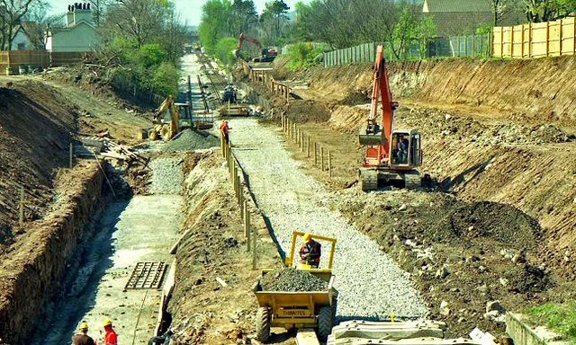
Image: © Albert Bridge Taken: 12 Apr 1997
See Image Just six days later and all traces of the old bridge have gone. The foundations for the new abutment can be seen (left) while (right) ballast for the new railway formation has been laid. Continue to Image (August 1997).
Images are licensed for reuse under creativecommons.org/licenses/by-sa/2.0
Image Location
Latitude
54.720842
Longitude
-5.791379