Talbot Village, almshouses
Introduction
The photograph on this page of Talbot Village, almshouses by Mike Faherty as part of the Geograph project.
The Geograph project started in 2005 with the aim of publishing, organising and preserving representative images for every square kilometre of Great Britain, Ireland and the Isle of Man.

There are currently over 7.5m images from over 14,400 individuals and you can help contribute to the project by visiting https://www.geograph.org.uk
Talbot Village, almshouses
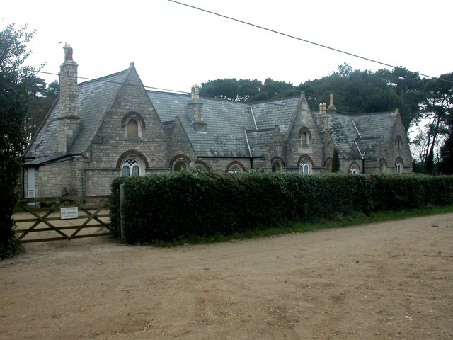
Image: © Mike Faherty Taken: 4 Jan 2009
English Heritage-listed almshouses built by Georgina Talbot in 1862 as part of her model village Image Could accommodate 14 people in 7 units; each had a pig sty & poultry run. Coal, doctor's fees, an allowance, building upkeep and burial expenses were paid for. At my visit, I couldn't detect pigs or poultry! http://www.imagesofengland.org.uk/Details/Default.aspx?id=101887&mode=adv
Images are licensed for reuse under creativecommons.org/licenses/by-sa/2.0
Image Location
Latitude
50.746461
Longitude
-1.899457