Auchinderran
Introduction
The photograph on this page of Auchinderran by Anne Burgess as part of the Geograph project.
The Geograph project started in 2005 with the aim of publishing, organising and preserving representative images for every square kilometre of Great Britain, Ireland and the Isle of Man.

There are currently over 7.5m images from over 14,400 individuals and you can help contribute to the project by visiting https://www.geograph.org.uk
Auchinderran
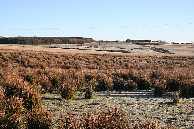
Image: © Anne Burgess Taken: 5 Jan 2009
The low winter sunshine shows up the undulations in the glacial till which blankets the land here. The rushes in the foreground tell us that the soil drains poorly, and this sort of wet land is difficult if not impossible to cultivate. It would have been a hard life for the occupants here, and for their horses, in bygone days when there were no tractors.
Images are licensed for reuse under creativecommons.org/licenses/by-sa/2.0
Image Location
Latitude
57.58133
Longitude
-2.991657