Hunthouse wood
Introduction
The photograph on this page of Hunthouse wood by Richard Greenwood as part of the Geograph project.
The Geograph project started in 2005 with the aim of publishing, organising and preserving representative images for every square kilometre of Great Britain, Ireland and the Isle of Man.

There are currently over 7.5m images from over 14,400 individuals and you can help contribute to the project by visiting https://www.geograph.org.uk
Hunthouse wood
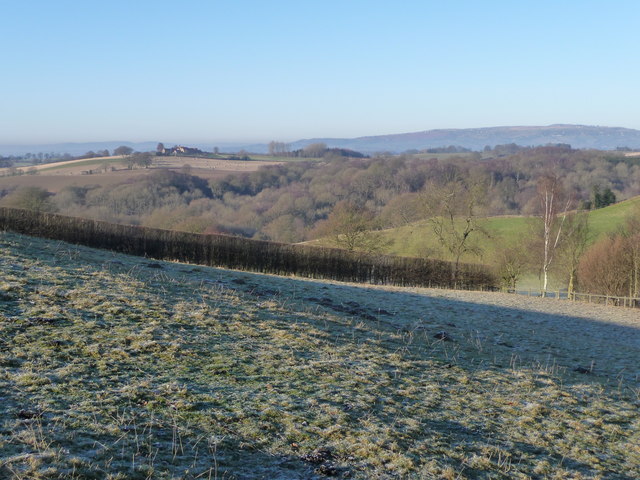
Image: © Richard Greenwood Taken: 3 Jan 2009
The wooded area is a Nature reserve, Hunthouse Wood which forms part of the Dumbleton Dingle SSSI. The Dumbleton Brook has cut a very steep valley and flows south to join the River Teme. Hunthouse farm (in the next square) is visible left of centre and on the skyline is Titterstone Clee Hill.
Images are licensed for reuse under creativecommons.org/licenses/by-sa/2.0
Image Location
Latitude
52.328548
Longitude
-2.435474