View from Dolydd Bridge: Afon Lwyd and lime doser
Introduction
The photograph on this page of View from Dolydd Bridge: Afon Lwyd and lime doser by John Gibson as part of the Geograph project.
The Geograph project started in 2005 with the aim of publishing, organising and preserving representative images for every square kilometre of Great Britain, Ireland and the Isle of Man.

There are currently over 7.5m images from over 14,400 individuals and you can help contribute to the project by visiting https://www.geograph.org.uk
View from Dolydd Bridge: Afon Lwyd and lime doser
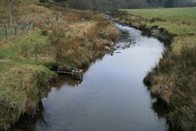
Image: © John Gibson Taken: 29 Dec 2008
The river marks the divide between forest and farmland. The apparatus in the metal cage in the water on the left comprises an acidity sensor and a pipe connected to a nearby lime doser. If the water becomes too acidic (due to acid rain), limestone powder is automatically released into the river to help restore the natural balance and protect plants and wildlife.
Images are licensed for reuse under creativecommons.org/licenses/by-sa/2.0
Image Location
Latitude
52.500971
Longitude
-3.662864