Cardross Parish Church
Introduction
The photograph on this page of Cardross Parish Church by Lairich Rig as part of the Geograph project.
The Geograph project started in 2005 with the aim of publishing, organising and preserving representative images for every square kilometre of Great Britain, Ireland and the Isle of Man.

There are currently over 7.5m images from over 14,400 individuals and you can help contribute to the project by visiting https://www.geograph.org.uk
Cardross Parish Church
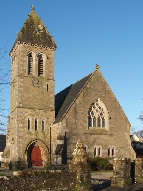
Image: © Lairich Rig Taken: 29 Dec 2008
Located on the corner of Church Avenue and Station Road, this former Free Church, built from 1871-2 (John Burnet), became the Parish Church when its predecessor, Dempster's church (Image), was damaged during the blitz. For different views of the same building, see Image and Image For more information on the succession of parish churches of Cardross, see: Image
Images are licensed for reuse under creativecommons.org/licenses/by-sa/2.0
Image Location
Latitude
55.962169
Longitude
-4.653356