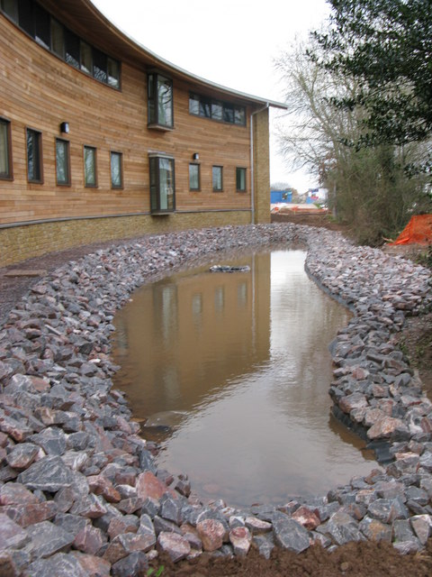
The Cullompton Health Centre Pond
Introduction
The photograph on this page of The Cullompton Health Centre Pond by brian lee as part of the Geograph project.
The Geograph project started in 2005 with the aim of publishing, organising and preserving representative images for every square kilometre of Great Britain, Ireland and the Isle of Man.
There are currently over 7.5m images from over 14,400 individuals and you can help contribute to the project by visiting https://www.geograph.org.uk

Image: © brian lee Taken: 25 Jan 2008
Not very visually appealing in this shot as we were still under construction. The site is built at the bottom of what was sloping agricultural land which in heavy rainfall conditions would contribute copious amounts of run off into the town's drainage system. This is not ideal as the site is at the top end of the drain system. The hole just visible in the centre of shot leads down into a holding tank which delays the release of excess water into the drains. More drainage tricks will be needed as we cover over the land behind this site with proposed housing.

