Elliot's Town from above
Introduction
The photograph on this page of Elliot's Town from above by Colin Bell as part of the Geograph project.
The Geograph project started in 2005 with the aim of publishing, organising and preserving representative images for every square kilometre of Great Britain, Ireland and the Isle of Man.

There are currently over 7.5m images from over 14,400 individuals and you can help contribute to the project by visiting https://www.geograph.org.uk
Elliot's Town from above
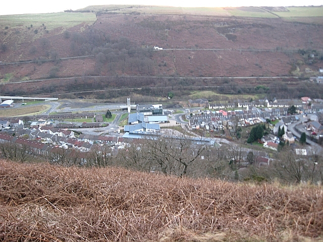
Image: © Colin Bell Taken: 25 Dec 2008
The buildings in the centre of the picture are the White Rose Primary School, library and community centre, with the colliery museum the grey-roofed building behind. They lie on either side of what used to be the main road up this side of the valley: the bypass was built further down, under the large white bridge seen end-on from this angle. The same applies on the other side of the valley: the old main road is the uppermost horizontal line with the bypass below it (and the railway below that).
Images are licensed for reuse under creativecommons.org/licenses/by-sa/2.0
Image Location
Latitude
51.717247
Longitude
-3.235133