Winscombe Fields & Hedges
Introduction
The photograph on this page of Winscombe Fields & Hedges by MD as part of the Geograph project.
The Geograph project started in 2005 with the aim of publishing, organising and preserving representative images for every square kilometre of Great Britain, Ireland and the Isle of Man.

There are currently over 7.5m images from over 14,400 individuals and you can help contribute to the project by visiting https://www.geograph.org.uk
Winscombe Fields & Hedges
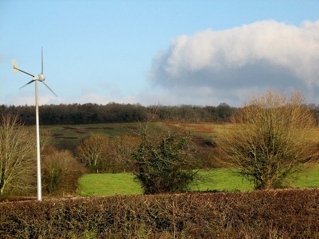
Image: © MD Taken: 25 Dec 2008
Taken just after midday on Christmas Day 2008, look - a rare moment of blue sky! The small turbine is situated at the back of Winscombe Primary School playing fields, the first school to have one in North Somerset (see link). The woods on the horizon are situated near the dis-used Sandford Quarry. http://www.thewestonmercury.co.uk/content/twm/news/story.aspx?brand=westonmercury&category=news&tBrand=westonmercury&tCategory=znews&itemid=WeED23%20Jan%202009%2015%3A28%3A32%3A017
Images are licensed for reuse under creativecommons.org/licenses/by-sa/2.0
Image Location


Leaflet Map data © OpenStreetMap
Latitude
51.317912
Longitude
-2.827179