Manlove Street, Penn Fields, Wolverhampton
Introduction
The photograph on this page of Manlove Street, Penn Fields, Wolverhampton by Roger D Kidd as part of the Geograph project.
The Geograph project started in 2005 with the aim of publishing, organising and preserving representative images for every square kilometre of Great Britain, Ireland and the Isle of Man.

There are currently over 7.5m images from over 14,400 individuals and you can help contribute to the project by visiting https://www.geograph.org.uk
Manlove Street, Penn Fields, Wolverhampton
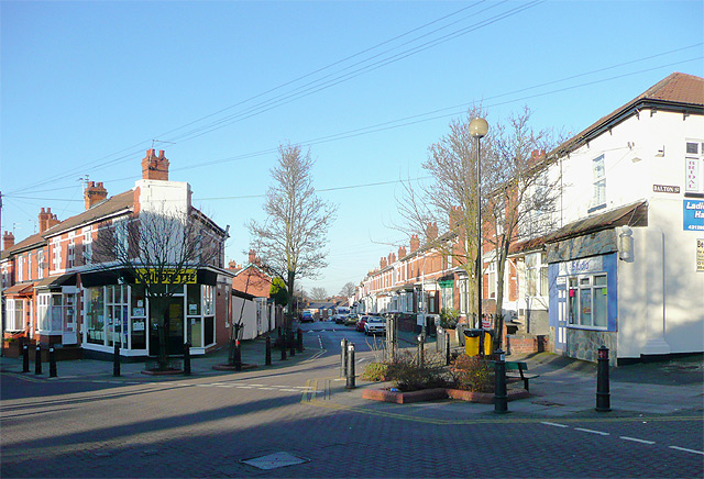
Image: © Roger D Kidd Taken: 26 Dec 2008
The housing all around is predominantly solid late Victorian and early 20th century, much of it terraced. Here the junction has five ways and the view is straight up Manlove Street from Owen Road (continuing to the left), with Dalton Street branching to the right by the white house. Some of the old corner shops have closed but others remain, now operated by a multi-cultural population. Some regeneration has been attempted by introducing many speed humps, a 20mph speed restriction, and attractively block paving the roads at the junction, giving a real urban village feel to the site. There is still a launderette here, and that has been a dying "species" for years. A larger image (2010) can be seen here Image]
Images are licensed for reuse under creativecommons.org/licenses/by-sa/2.0
Image Location
Latitude
52.5773
Longitude
-2.142211