Montfode Castle & farm
Introduction
The photograph on this page of Montfode Castle & farm by Leslie Barrie as part of the Geograph project.
The Geograph project started in 2005 with the aim of publishing, organising and preserving representative images for every square kilometre of Great Britain, Ireland and the Isle of Man.

There are currently over 7.5m images from over 14,400 individuals and you can help contribute to the project by visiting https://www.geograph.org.uk
Montfode Castle & farm
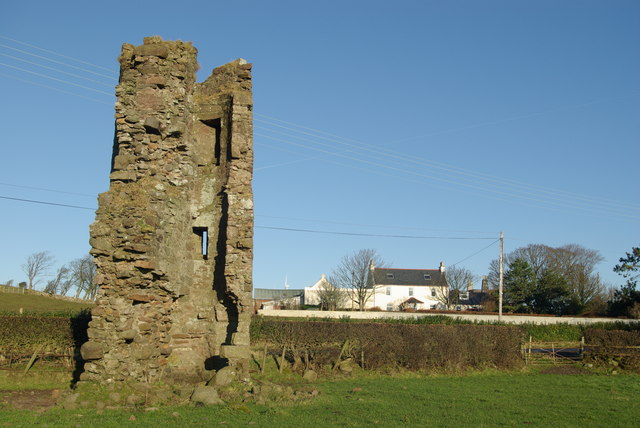
Image: © Leslie Barrie Taken: 6 Dec 2008
Remains of a 16th-century Z-plan tower house of the Montfodes of that Ilk. The family became extinct in the 17th-century. In the 19th-century the castle was mostly demolished; the stonework being used in the construction of a nearby mill.
Images are licensed for reuse under creativecommons.org/licenses/by-sa/2.0
Image Location
Latitude
55.658585
Longitude
-4.82039