
Cholesbury Telephone Exchange
Introduction
The photograph on this page of Cholesbury Telephone Exchange by David Hillas as part of the Geograph project.
The Geograph project started in 2005 with the aim of publishing, organising and preserving representative images for every square kilometre of Great Britain, Ireland and the Isle of Man.

There are currently over 7.5m images from over 14,400 individuals and you can help contribute to the project by visiting https://www.geograph.org.uk
Cholesbury Telephone Exchange
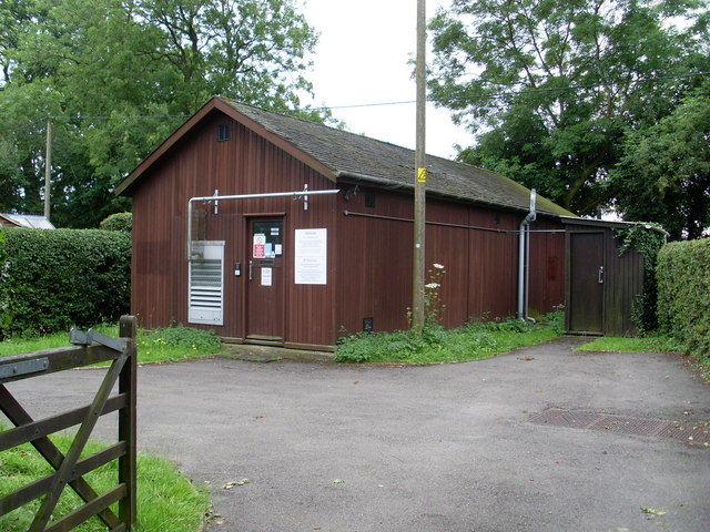
Image: © David Hillas Taken: 14 Jul 2008
Situated near The Full Moon PH, this TE, which has the code SMCHY, replaced the one on Sandpit Hill, now demolished. It provides telephone and broadband services to 672 residential and 37 non-residential premises in Cholesbury plus Asheridge, Bellingdon, Buckland Common, Hawridge and St Leonards nearby. The louvres at the front presumably keeps the TE air-cooled. It has (01494) 758xxx numbers, the (01494) referring to the High Wycombe group of sixteen TEs, and its postcode is HP5 2UH.
Images are licensed for reuse under creativecommons.org/licenses/by-sa/2.0
Image Location

Latitude
51.752979
Longitude
-0.645146