Battlebridge Hall
Introduction
The photograph on this page of Battlebridge Hall by Ian Capper as part of the Geograph project.
The Geograph project started in 2005 with the aim of publishing, organising and preserving representative images for every square kilometre of Great Britain, Ireland and the Isle of Man.

There are currently over 7.5m images from over 14,400 individuals and you can help contribute to the project by visiting https://www.geograph.org.uk
Battlebridge Hall
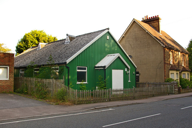
Image: © Ian Capper Taken: 15 Jun 2008
This hall in Frenches Road has the appearance of a "tin tabernacle", the nickname given to corrugated iron structures, often used for mission churches, around the turn of the 19th/20th centuries. I have not been able to identify its history, other than a reference to its use by All Saints Church Merstham near the beginning of the second world war, and more recent references to "Battlebridge Education Centre" at what would appear to be this address. The name "Battlebridge Hall" is what appears on very large scale maps.
Images are licensed for reuse under creativecommons.org/licenses/by-sa/2.0
Image Location
Latitude
51.252213
Longitude
-0.158429