Bridgeton Cross
Introduction
The photograph on this page of Bridgeton Cross by G Laird as part of the Geograph project.
The Geograph project started in 2005 with the aim of publishing, organising and preserving representative images for every square kilometre of Great Britain, Ireland and the Isle of Man.

There are currently over 7.5m images from over 14,400 individuals and you can help contribute to the project by visiting https://www.geograph.org.uk
Bridgeton Cross
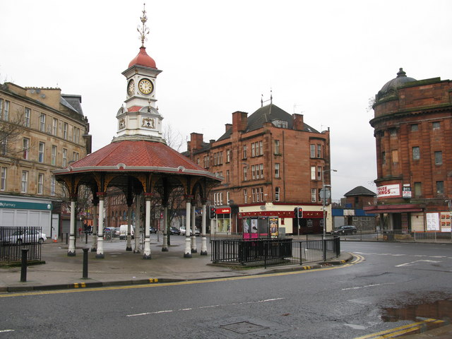
Image: © G Laird Taken: 14 Dec 2008
Bridgeton Cross's best known landmark is 'The Umbrella' which with its clock tower is 50 feet high. It was originally built to shelter the unemployed in 1875. The road in the background is the A74 looking in the direction of Glasgow City Centre. The road in the foreground leads to roads to Rutherglen and Cambuslang.
Images are licensed for reuse under creativecommons.org/licenses/by-sa/2.0
Image Location
Latitude
55.848583
Longitude
-4.226067