Junction of Whateley & Rushy Lanes
Introduction
The photograph on this page of Junction of Whateley & Rushy Lanes by Rob Farrow as part of the Geograph project.
The Geograph project started in 2005 with the aim of publishing, organising and preserving representative images for every square kilometre of Great Britain, Ireland and the Isle of Man.

There are currently over 7.5m images from over 14,400 individuals and you can help contribute to the project by visiting https://www.geograph.org.uk
Junction of Whateley & Rushy Lanes
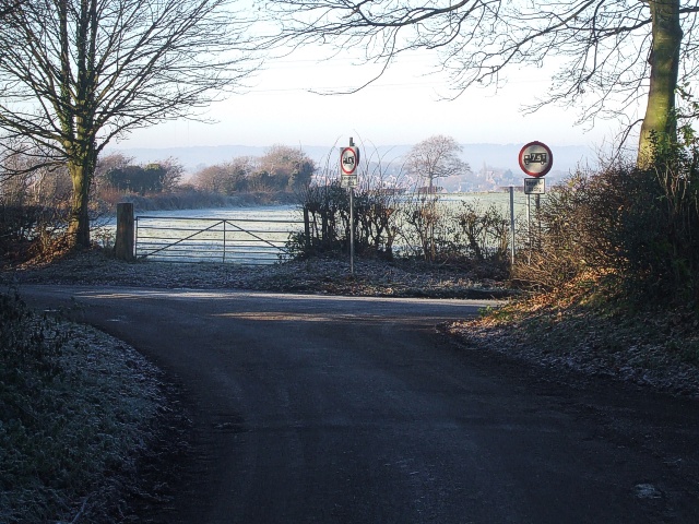
Image: © Rob Farrow Taken: 7 Dec 2008
Taken from near the entrance to Whateley Hall Farm looking due westwards. Whateley Lane continues to the right while the lane to the left is Rushy Lane which descends about 100 feet until it meets the Dosthill to Kingsbury road just south of Dosthill. Rushy Lane is shown on all modern maps as "Rush Lane" this is almost certainly due to cartographic error many years ago when the "y" of Rushy was written round a bend from the rest of the lane and was obviously missed by the subsequent map maker.
Images are licensed for reuse under creativecommons.org/licenses/by-sa/2.0
Image Location
Latitude
52.592287
Longitude
-1.665604