Clydeview, near the shore at Levengrove
Introduction
The photograph on this page of Clydeview, near the shore at Levengrove by Lairich Rig as part of the Geograph project.
The Geograph project started in 2005 with the aim of publishing, organising and preserving representative images for every square kilometre of Great Britain, Ireland and the Isle of Man.

There are currently over 7.5m images from over 14,400 individuals and you can help contribute to the project by visiting https://www.geograph.org.uk
Clydeview, near the shore at Levengrove
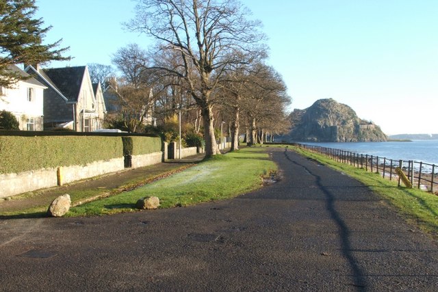
Image: © Lairich Rig Taken: 3 Dec 2008
This rather short row of houses is called Clydeview; the photograph was taken from the junction with Clydeshore Road. (Specifically, it was taken from the same point at which some people and a car are located in the following photograph, which was taken while facing in the opposite direction: Image) For a view back along this short road from the other end, see Image Levengrove Park adjoins these houses on the north and on the east; following the pavement that recedes into the distance in this photograph leads to a gate into the park; a footpath there continues along the waterfront (Image), and passes a war memorial (Image). The volcanic plug of Dumbarton Rock is visible in the background. See also: Image
Images are licensed for reuse under creativecommons.org/licenses/by-sa/2.0
Image Location
Latitude
55.938245
Longitude
-4.577894