Constitution Hill
Introduction
The photograph on this page of Constitution Hill by Peter Shaw as part of the Geograph project.
The Geograph project started in 2005 with the aim of publishing, organising and preserving representative images for every square kilometre of Great Britain, Ireland and the Isle of Man.

There are currently over 7.5m images from over 14,400 individuals and you can help contribute to the project by visiting https://www.geograph.org.uk
Constitution Hill
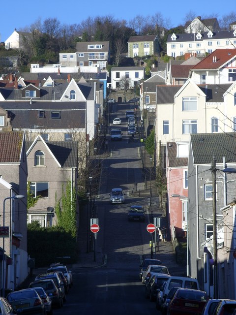
Image: © Peter Shaw Taken: 6 Dec 2008
A steep cobbled hill leading from Walters Road to Terrace road. A funicular railway operated on the hill between 1898 and 1903 on a gradient of between 14% and 28.6%. The hill has often been used in a stage of the Round Britain cycle race. For a view from the top follow this http://www.geograph.org.uk/photo/1088271 .
Images are licensed for reuse under creativecommons.org/licenses/by-sa/2.0
Image Location
Latitude
51.622303
Longitude
-3.955583