Old Mill Farm
Introduction
The photograph on this page of Old Mill Farm by Hugh Craddock as part of the Geograph project.
The Geograph project started in 2005 with the aim of publishing, organising and preserving representative images for every square kilometre of Great Britain, Ireland and the Isle of Man.

There are currently over 7.5m images from over 14,400 individuals and you can help contribute to the project by visiting https://www.geograph.org.uk
Old Mill Farm
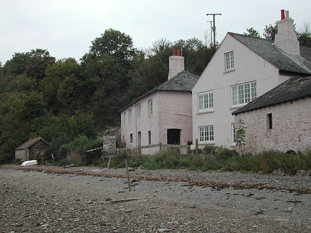
Image: © Hugh Craddock Taken: 22 Oct 2003
As reported here: Image, the public footpath past the property has been the subject of heated dispute, including a successful challenge in the High Court: http://www.bailii.org/ew/cases/EWHC/Admin/2007/1209.html. At issue is whether the path leaves the foreshore to join the drive past the wooden waymark (just left of the ground floor window), or continues along the foreshore to join Mill Lane where it becomes a public road (about 30m further on). Just left of the waymark post is a notice suggesting walkers use the latter route.
Images are licensed for reuse under creativecommons.org/licenses/by-sa/2.0
Image Location
Latitude
50.38958
Longitude
-3.577316