Wartime structure at Llanungar Fawr
Introduction
The photograph on this page of Wartime structure at Llanungar Fawr by Natasha Ceridwen de Chroustchoff as part of the Geograph project.
The Geograph project started in 2005 with the aim of publishing, organising and preserving representative images for every square kilometre of Great Britain, Ireland and the Isle of Man.

There are currently over 7.5m images from over 14,400 individuals and you can help contribute to the project by visiting https://www.geograph.org.uk
Wartime structure at Llanungar Fawr
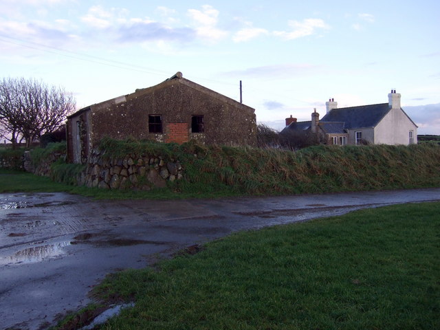
Image: © Natasha Ceridwen de Chroustchoff Taken: 28 Nov 2008
All the built structures (apart from the runways) were removed from the airfield proper when it was acquired by the PCNP but a few linger in the vicinity. They were perhaps sleeping quarters for the servicemen, and were subsequently taken over for farm use like this brick, concrete and asbestos building at Llanungar Fawr on the southern perimeter of the airfield.
Images are licensed for reuse under creativecommons.org/licenses/by-sa/2.0
Image Location
Latitude
51.882493
Longitude
-5.207136