Balado NATO satellite ground station
Introduction
The photograph on this page of Balado NATO satellite ground station by Veedar as part of the Geograph project.
The Geograph project started in 2005 with the aim of publishing, organising and preserving representative images for every square kilometre of Great Britain, Ireland and the Isle of Man.

There are currently over 7.5m images from over 14,400 individuals and you can help contribute to the project by visiting https://www.geograph.org.uk
Balado NATO satellite ground station
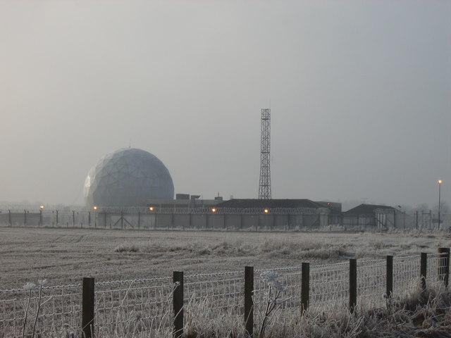
Image: © Veedar Taken: 31 Jan 2006
Picture taken of Balado satellite ground station on 31st January 2006. The Balado Bridge NATO Satellite Ground Station, which closed in 2006, is on the southern perimeter of the disused RAF Kinross airfield. Poultry sheds of Balado Poultry Farm now occupy the concrete runways of the old airfield.
Images are licensed for reuse under creativecommons.org/licenses/by-sa/2.0
Image Location
Latitude
56.209673
Longitude
-3.461873