The former Eagles Nest, Coningsby Drive, Kidderminster
Introduction
The photograph on this page of The former Eagles Nest, Coningsby Drive, Kidderminster by P L Chadwick as part of the Geograph project.
The Geograph project started in 2005 with the aim of publishing, organising and preserving representative images for every square kilometre of Great Britain, Ireland and the Isle of Man.

There are currently over 7.5m images from over 14,400 individuals and you can help contribute to the project by visiting https://www.geograph.org.uk
The former Eagles Nest, Coningsby Drive, Kidderminster
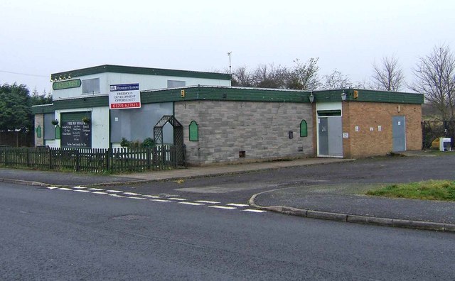
Image: © P L Chadwick Taken: 29 Nov 2008
The Eagles Nest was a typical post-World War II estate pub, situated in the middle of the Ferndale area, on the edge of Kidderminster. The sign "Freehold Development Opportunity" says it all. The Council have given permission for the demolition of the pub and replacement by housing. The large car park to the right of the pub gives plenty of space for the redevelopment. When the pub was open, it looked like this: Image
Images are licensed for reuse under creativecommons.org/licenses/by-sa/2.0
Image Location
Latitude
52.396452
Longitude
-2.277275