Steps up to the shaft at Higher Bal
Introduction
The photograph on this page of Steps up to the shaft at Higher Bal by M Hunter as part of the Geograph project.
The Geograph project started in 2005 with the aim of publishing, organising and preserving representative images for every square kilometre of Great Britain, Ireland and the Isle of Man.

There are currently over 7.5m images from over 14,400 individuals and you can help contribute to the project by visiting https://www.geograph.org.uk
Steps up to the shaft at Higher Bal
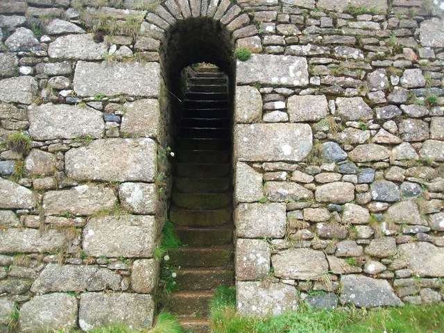
Image: © M Hunter Taken: 3 Aug 2008
These steps lead up to the top of the shaft at Higher Bal. The enormous masonry structure is reminiscent more of a castle from the dark ages than a 19th century industrial structure.
Images are licensed for reuse under creativecommons.org/licenses/by-sa/2.0
Image Location
Latitude
50.148497
Longitude
-5.682787