Rhymney Valley
Introduction
The photograph on this page of Rhymney Valley by Robin Drayton as part of the Geograph project.
The Geograph project started in 2005 with the aim of publishing, organising and preserving representative images for every square kilometre of Great Britain, Ireland and the Isle of Man.

There are currently over 7.5m images from over 14,400 individuals and you can help contribute to the project by visiting https://www.geograph.org.uk
Rhymney Valley
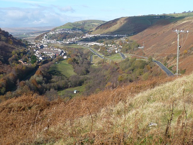
Image: © Robin Drayton Taken: 12 Nov 2008
The view northwards up the Rhymney Valley. Communities visible are Cwmsyfiog, Elliot's Town, Phillip's Town and New Tredegar on the east side of the valley. On the west side are Brithdir and Tirphil. In the distance is Abertysswg.
Images are licensed for reuse under creativecommons.org/licenses/by-sa/2.0
Image Location
Latitude
51.701207
Longitude
-3.221238