Capel a Ty Capel Paran
Introduction
The photograph on this page of Capel a Ty Capel Paran by Eric Jones as part of the Geograph project.
The Geograph project started in 2005 with the aim of publishing, organising and preserving representative images for every square kilometre of Great Britain, Ireland and the Isle of Man.

There are currently over 7.5m images from over 14,400 individuals and you can help contribute to the project by visiting https://www.geograph.org.uk
Capel a Ty Capel Paran
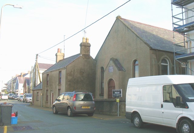
Image: © Eric Jones Taken: 14 Nov 2008
The present Welsh Calvinistic Methodist chapel and chapel house date from 1887. The Calvinists however had had a Sunday School building, a branch of Bryn Du Chapel, on the site since the beginning of the 19thC. In 1850 this was replaced by a small chapel, although it had neither seats or a pulpit until 1867. During the WWII part of the chapel was used for billeting troops. Paran remains open.
Images are licensed for reuse under creativecommons.org/licenses/by-sa/2.0
Image Location
Latitude
53.226429
Longitude
-4.521583