Trafford Centre
Introduction
The photograph on this page of Trafford Centre by Phil Williams as part of the Geograph project.
The Geograph project started in 2005 with the aim of publishing, organising and preserving representative images for every square kilometre of Great Britain, Ireland and the Isle of Man.

There are currently over 7.5m images from over 14,400 individuals and you can help contribute to the project by visiting https://www.geograph.org.uk
Trafford Centre
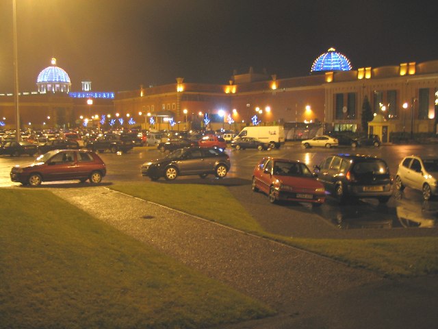
Image: © Phil Williams Taken: 30 Dec 2005
Haphazard parking is still in evidence as the aftermath of a day's bargain hunting at the Trafford Centre. A view looking north across the carpark at what was previously the Village end of the complex, now replaced by a department store. The large blue dome at left is the main cupola adjacent to the Orient section of the complex.
Images are licensed for reuse under creativecommons.org/licenses/by-sa/2.0
Image Location


Leaflet Map data © OpenStreetMap
Latitude
53.465629
Longitude
-2.349422