
Macgregors' Burial Ground, Loch Katrine
Introduction
The photograph on this page of Macgregors' Burial Ground, Loch Katrine by ronnie leask as part of the Geograph project.
The Geograph project started in 2005 with the aim of publishing, organising and preserving representative images for every square kilometre of Great Britain, Ireland and the Isle of Man.

There are currently over 7.5m images from over 14,400 individuals and you can help contribute to the project by visiting https://www.geograph.org.uk
Macgregors' Burial Ground, Loch Katrine
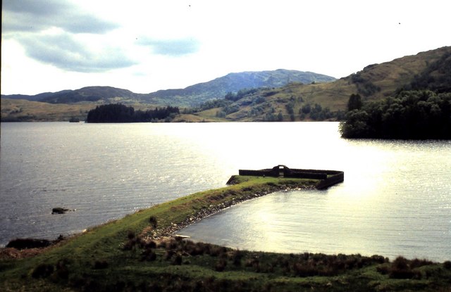
Image: © ronnie leask Taken: Unknown
When the water level was raised on Loch Katrine in the 1850's as part of the scheme to provide a water supply for Glasgow a wall was built around the graveyard, earth piled on top of the graves and a causeway built to the shore. The graves then are now deep in the ground! There is another graveyard for chiefs of the clan at Glengyle at the head of the loch.
Images are licensed for reuse under creativecommons.org/licenses/by-sa/2.0
Image Location

Latitude
56.27273
Longitude
-4.575809