Lodge, Burnley Road A646, Mytholmroyd
Introduction
The photograph on this page of Lodge, Burnley Road A646, Mytholmroyd by Humphrey Bolton as part of the Geograph project.
The Geograph project started in 2005 with the aim of publishing, organising and preserving representative images for every square kilometre of Great Britain, Ireland and the Isle of Man.

There are currently over 7.5m images from over 14,400 individuals and you can help contribute to the project by visiting https://www.geograph.org.uk
Lodge, Burnley Road A646, Mytholmroyd
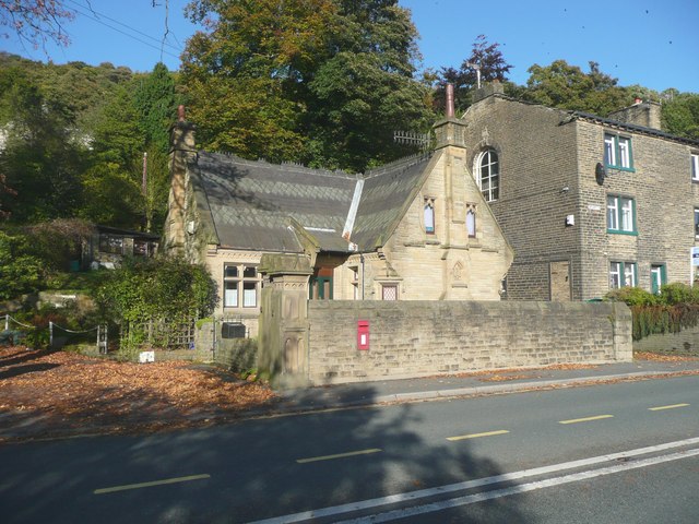
Image: © Humphrey Bolton Taken: 16 Oct 2008
This is the lodge for Brearley House, and is a listed building, which presumably means it is considered to be a particularly good example of late 19C lodges. It certainly has an imaginative mixture of styles. Good that the decorative pattern in the roof tiles has survived.
Images are licensed for reuse under creativecommons.org/licenses/by-sa/2.0
Image Location


Leaflet Map data © OpenStreetMap
Latitude
53.730389
Longitude
-1.960553