Flats and football grounds
Introduction
The photograph on this page of Flats and football grounds by Paul McIlroy as part of the Geograph project.
The Geograph project started in 2005 with the aim of publishing, organising and preserving representative images for every square kilometre of Great Britain, Ireland and the Isle of Man.

There are currently over 7.5m images from over 14,400 individuals and you can help contribute to the project by visiting https://www.geograph.org.uk
Flats and football grounds
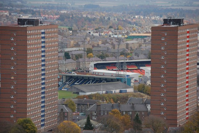
Image: © Paul McIlroy Taken: 8 Nov 2008
The highest point in Dundee is at the top of the volcanic plug know as Dundee Law. This is where the memorial to the local men and women who lost their lives in the 1914-18 war, is situated. It is a good point to view Dundee and the Tay estuary.This picture shows the multi- storey flats at Strathmartine Road and the football grounds of Dundee FC (Dens Park) and Dundee United (Tannadice Park)
Images are licensed for reuse under creativecommons.org/licenses/by-sa/2.0
Image Location
Latitude
56.47399
Longitude
-2.969574