Mixed woodland around the Penkiln Burn
Introduction
The photograph on this page of Mixed woodland around the Penkiln Burn by David Baird as part of the Geograph project.
The Geograph project started in 2005 with the aim of publishing, organising and preserving representative images for every square kilometre of Great Britain, Ireland and the Isle of Man.

There are currently over 7.5m images from over 14,400 individuals and you can help contribute to the project by visiting https://www.geograph.org.uk
Mixed woodland around the Penkiln Burn
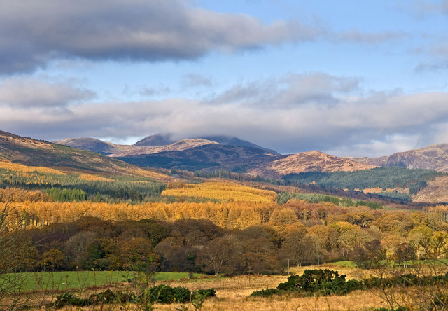
Image: © David Baird Taken: 5 Nov 2008
Ancient oak woods border the Penkiln Burn in the middle distance, giving way to commercial forestry plantations of spruce and larch further up the glen. The ridge of Black Benwee, White Benwee and Bennan Hill leads from the right of the picture up towards Curleywee with its top partly hidden in the cloud.
Images are licensed for reuse under creativecommons.org/licenses/by-sa/2.0
Image Location
Latitude
54.98643
Longitude
-4.447404