The weir at Stair
Introduction
The photograph on this page of The weir at Stair by Gordon Brown as part of the Geograph project.
The Geograph project started in 2005 with the aim of publishing, organising and preserving representative images for every square kilometre of Great Britain, Ireland and the Isle of Man.

There are currently over 7.5m images from over 14,400 individuals and you can help contribute to the project by visiting https://www.geograph.org.uk
The weir at Stair
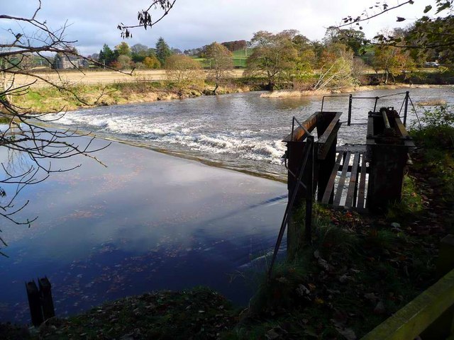
Image: © Gordon Brown Taken: 8 Nov 2008
Control gates for the lade can be seen to the right. The River Ayr does a tight meander here, with a good fall in height, making it ideal for water-powered mills. According to Dane Love in "The River Ayr Way" there were three mills here - a corn mill, a lint mill and a seed mill (for cleaning grass seed).
Images are licensed for reuse under creativecommons.org/licenses/by-sa/2.0
Image Location
Latitude
55.481359
Longitude
-4.473574