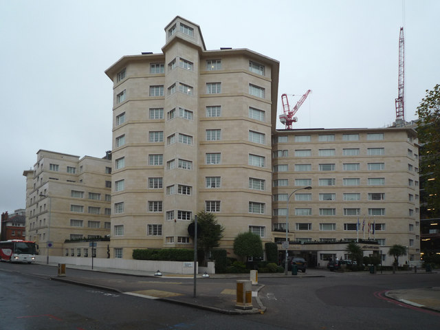
The Meli? White House
Introduction
The photograph on this page of The Meli? White House by Ian Capper as part of the Geograph project.
The Geograph project started in 2005 with the aim of publishing, organising and preserving representative images for every square kilometre of Great Britain, Ireland and the Isle of Man.
There are currently over 7.5m images from over 14,400 individuals and you can help contribute to the project by visiting https://www.geograph.org.uk

Image: © Ian Capper Taken: 6 Nov 2008
The White House was first opened in 1936 as an apartment building of 758 luxury apartments, both furnished and unfurnished, at a cost of £350,000. Entry was via an imposing entrance hall, opening into a lounge, which then led to a restaurant, swimming pool and squash courts. The building also included a Bar, various shops and a roof garden. With these facilities and a position at the head of Great Portland Street and on the edge of Regents Park, the White House was one of the most exclusive addresses in London. Membership of the White House Club meant that non-residents could also gain access to the facilities there. With its unusual shape (the main feature being two diagonal arms at each end of the building), the White House has a very distinctive profile. During the Second World War this was used by the Luftwaffe to help them get their bearings for bombing raids in London. As a result, the building survived unscathed. The White House Club retained its popularity during the 1950s, with facilities and membership expanding. However, from 1959, new owners started its conversion to a hotel. By 1970 the transformation was largely complete, but with one wing retained for permanent residents. From 1972 to 1999 it was owned by the Rank Organisation. In 1999 it was bought by the Spanish hotel group Sol Meliá, and given its present name. It is primarily a hotel but still retains around 100 apartments for longer term residents. This photo shows the southwest wing, with the main entrance behind. In the background are cranes working on the Regents Place development.
Image Location


