Signs to Durlston
Introduction
The photograph on this page of Signs to Durlston by Jim Champion as part of the Geograph project.
The Geograph project started in 2005 with the aim of publishing, organising and preserving representative images for every square kilometre of Great Britain, Ireland and the Isle of Man.

There are currently over 7.5m images from over 14,400 individuals and you can help contribute to the project by visiting https://www.geograph.org.uk
Signs to Durlston
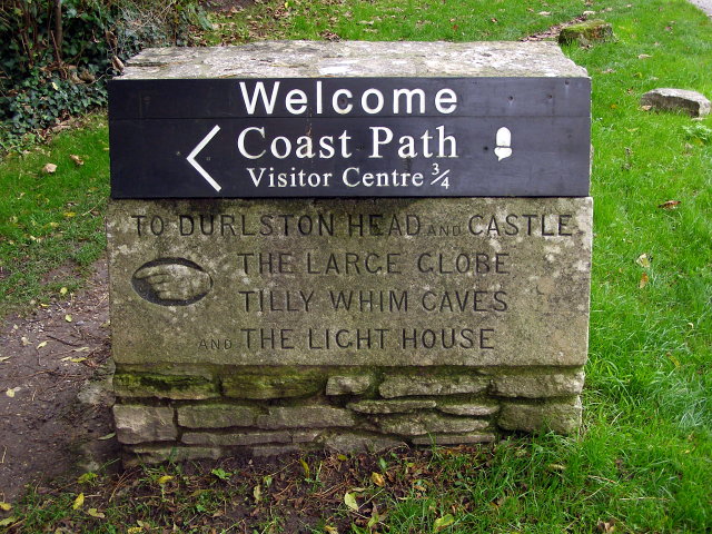
Image: © Jim Champion Taken: 27 Oct 2008
This new and old sign both point down a track which joins with the 'Isle of Wight Road', a walled track along the top of the cliffs in Durlston Bay. A landslip in Durlston Bay has made necessary this slight inland detour of the coast path. The Large Globe and Light House can still be visited. It has not been possible to go into Tilly Whim caves since they were shut to the public in 1976. The Head is still there and the Castle is being refurbished as a Jurassic Coast visitor centre.
Images are licensed for reuse under creativecommons.org/licenses/by-sa/2.0
Image Location
Latitude
50.601083
Longitude
-1.956003