William Reynolds House, Street
Introduction
The photograph on this page of William Reynolds House, Street by Derek Harper as part of the Geograph project.
The Geograph project started in 2005 with the aim of publishing, organising and preserving representative images for every square kilometre of Great Britain, Ireland and the Isle of Man.

There are currently over 7.5m images from over 14,400 individuals and you can help contribute to the project by visiting https://www.geograph.org.uk
William Reynolds House, Street
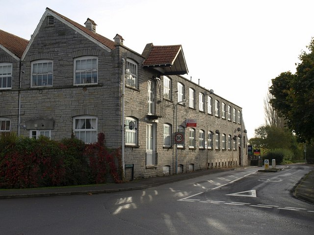
Image: © Derek Harper Taken: 24 Oct 2008
"The building now known as William Reynolds House (formerly Bowling Green Mill) is the surviving part of a much larger complex of buildings. This factory started about 1836 for sheepskin tanning powered by water from the nearby watercourse. In 1877 the factory was adapted to produce leather board. The façade of the surviving building was built between 1891 and 1906 by William Reynolds, architect for C & J Clark." http://www.mendip.gov.uk/Documents/Regeneration/Heritage%20Conservation/Conservation%20Area%20Appraisals/Street/Street%20Conservation%20Area%20Boundary%20Review%20-%20Urban%20Area.pdf Like so many buildings in the area, the material is Lias. The road on the right is simply called "Bowling Green" and leads to Street Drove.
Images are licensed for reuse under creativecommons.org/licenses/by-sa/2.0
Image Location
Latitude
51.131424
Longitude
-2.731662