Start of the Ardoch to Levengrove right of way
Introduction
The photograph on this page of Start of the Ardoch to Levengrove right of way by Lairich Rig as part of the Geograph project.
The Geograph project started in 2005 with the aim of publishing, organising and preserving representative images for every square kilometre of Great Britain, Ireland and the Isle of Man.

There are currently over 7.5m images from over 14,400 individuals and you can help contribute to the project by visiting https://www.geograph.org.uk
Start of the Ardoch to Levengrove right of way
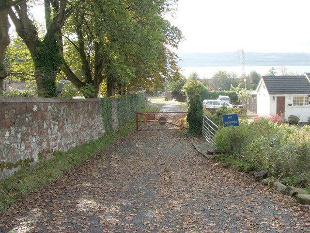
Image: © Lairich Rig Taken: 20 Oct 2006
This lane was photographed from the point where it branches off from Image; this is also the location of the signpost that marks the start of the right of way. The lane leads a short distance downhill, and then through a railway underpass, emerging at the shore. For another view of the same area, but looking back uphill from the other side of the gate, see: Image As for the right of way to Levengrove, much of the path, which is located in a grassy fringe above the shore, is often extremely overgrown with bramble stems and similar vegetation; depending on the tide, it may be easier either to walk along the shore itself, or to follow the edges of the fields that lie on the other side of the path.
Images are licensed for reuse under creativecommons.org/licenses/by-sa/2.0
Image Location
Latitude
55.951511
Longitude
-4.622189