Caverton Mill
Introduction
The photograph on this page of Caverton Mill by Walter Baxter as part of the Geograph project.
The Geograph project started in 2005 with the aim of publishing, organising and preserving representative images for every square kilometre of Great Britain, Ireland and the Isle of Man.

There are currently over 7.5m images from over 14,400 individuals and you can help contribute to the project by visiting https://www.geograph.org.uk
Caverton Mill
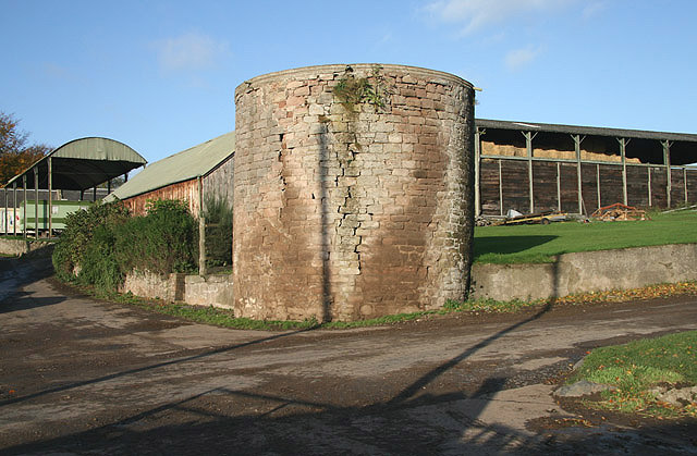
Image: © Walter Baxter Taken: 24 Oct 2008
Farm buildings with the remains of a windmill in the foreground. The circular stone base survives and it is believed to be only one of two windmills in the Scottish Borders area, the other being near Kippilaw Image
Images are licensed for reuse under creativecommons.org/licenses/by-sa/2.0
Image Location
Latitude
55.525294
Longitude
-2.39787