The Turnpike
Introduction
The photograph on this page of The Turnpike by Simon Carey as part of the Geograph project.
The Geograph project started in 2005 with the aim of publishing, organising and preserving representative images for every square kilometre of Great Britain, Ireland and the Isle of Man.

There are currently over 7.5m images from over 14,400 individuals and you can help contribute to the project by visiting https://www.geograph.org.uk
The Turnpike
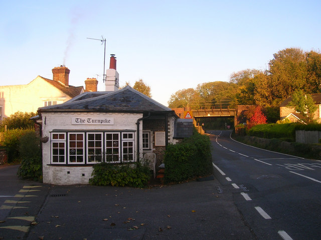
Image: © Simon Carey Taken: 24 Oct 2008
Former toll cottage on the modern B2139 at Houghton Bridge. The turnpike itself was opened in 1813 taking over the old route from Whiteways Lodge via the 14th century Houghton Bridge to a point south of Amberley. From here a new road was constructed to Storrington that by-passed the grounds of Parham House to the south which enabled the owners to close the old road that ran next to the house to the north. The current B2139 follows the entire route today. Beyond the cottage is the railway bridge next to Amberley station.
Images are licensed for reuse under creativecommons.org/licenses/by-sa/2.0
Image Location
Latitude
50.897027
Longitude
-0.542579