Boxley Mill leat
Introduction
The photograph on this page of Boxley Mill leat by Penny Mayes as part of the Geograph project.
The Geograph project started in 2005 with the aim of publishing, organising and preserving representative images for every square kilometre of Great Britain, Ireland and the Isle of Man.

There are currently over 7.5m images from over 14,400 individuals and you can help contribute to the project by visiting https://www.geograph.org.uk
Boxley Mill leat
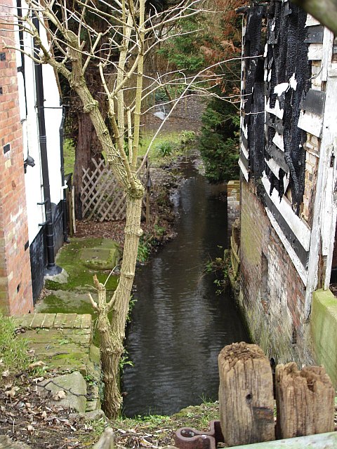
Image: © Penny Mayes Taken: 5 Jan 2006
Image stands on the left, the fire damaged remains of the mill on the right. It is marked on the 19th century map as a cornmill but I think the original mill building must have been much taller than these charred remains suggest. See also Image
Images are licensed for reuse under creativecommons.org/licenses/by-sa/2.0
Image Location
Latitude
51.29591
Longitude
0.51441