Sundial, Adderley
Introduction
The photograph on this page of Sundial, Adderley by Mike Faherty as part of the Geograph project.
The Geograph project started in 2005 with the aim of publishing, organising and preserving representative images for every square kilometre of Great Britain, Ireland and the Isle of Man.

There are currently over 7.5m images from over 14,400 individuals and you can help contribute to the project by visiting https://www.geograph.org.uk
Sundial, Adderley
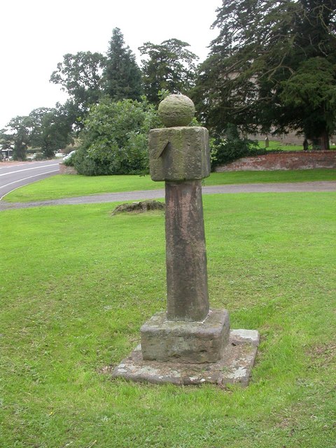
Image: © Mike Faherty Taken: 26 Aug 2008
Plain sun-dial with steps, circular shaft, square head with 2 surviving gnomons and ball finial. Dated 1774 according to local records. Those parishioners who could tell the time would no doubt have found it useful to discover whether they were early, late or on time for communion.
Images are licensed for reuse under creativecommons.org/licenses/by-sa/2.0
Image Location
Latitude
52.952249
Longitude
-2.506015